 |
 |
|
|
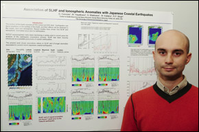
From the Ground UpMason center is close to achieving an earthquake prediction systemBy Robin Herron Within 30 minutes of an earthquake occurring somewhere in the world, the computer program Guido Cervone, MS Computer Science ’00 and PhD Computational Sciences and Informatics ’05, spent two years designing automatically generates an analysis, complete with color charts and graphs. Now Cervone, who works for Mason’s Center for Earth Observing and Space Research (CEOSR), has turned his attention from retrospective analysis to forecasting, an area of research expected to intensify in the wake of the deadly December 26 Sumatran earthquake and tsunami. Forecasting, however, is tricky. “The problem with earthquake prediction is that there have been many false alarms,” says Menas Kafatos, CEOSR director and dean of the School of Computational Sciences. “That has caused people to be very cautious, including ourselves.” But shortly after the December 26 event, the center’s ongoing monitoring of earthquakes led fellow CEOSR scientist and visiting professor Ramesh Singh to take the bold step of issuing a warning to India. On February 3, an earthquake that measured 5.5 on the Richter scale hit India’s Assam region as Singh had warned. Cervone began working with Singh while Cervone was a doctoral student. “With his background in earthquakes and my background in data mining, we made a good team,” Cervone says. Using five years of retrospective data from 300 earthquakes, they developed their analysis system, which became the basis for Cervone’s dissertation. Cervone’s work involves monitoring atmospheric anomalies observed through remote sensing, which are correlated to earthquakes. Last December’s massive 8.9-magnitude earthquake in the Indian Ocean, which caused the devastating tsunami, has provided mounds of data that can help in refining the system. The center has developed a web site, ceosr.gmu.edu/Tsunami-04.html, which provides numerous data and links, including an analysis that shows precursors to the deadly event. “We believe that in the case of coastal earthquakes, there is a strong interaction between the lithosphere [the outer surface of the earth], the hydrosphere [bodies of water and vapor in the atmosphere], and the atmosphere,” Cervone says. “So even though earthquakes only occur in the ocean or on land, their effects can be seen in the atmosphere. With our global remote sensing, we can study the atmosphere daily very well.” What primarily interests Singh, Cervone, and Kafatos is an anomaly called surface latent heat flux. Latent heat is heat that changes only the structure or phase of a material, not its temperature. When coastal earthquakes occur, the earthquake’s motion causes the surface temperature to increase thereby causing water to evaporate. The CEOSR scientists believe this anomaly may be the key to successful forecasting. And the signs are promising. On January 1, Cervone forecast an earthquake off Japan’s coast; eight days later, a 5.3-magnitude earthquake occurred where he had predicted. His system has also shown that the weaker the earthquake, the shorter the time span between when the anomaly is spotted and when the earthquake occurs. A massive earthquake has a much longer time span between the appearance of an anomaly and the actual event, which may allow more time for preparation or evacuation. To refine his analysis system, Cervone is trying to integrate different anomalies. “Our work in the past few months has been to try to combine our methods with those of other groups around the world to find out what signals predate earthquakes,” he says. With the Sumatran tsunami fresh on people’s minds, Kafatos feels that a sense of urgency will propel research and action to increase the accuracy of forecasting. “I don’t think it’s business as usual,” he says. “Seventy-five percent of the world’s population lives near the coast.” |
Guido Cervone |